Visual Earth

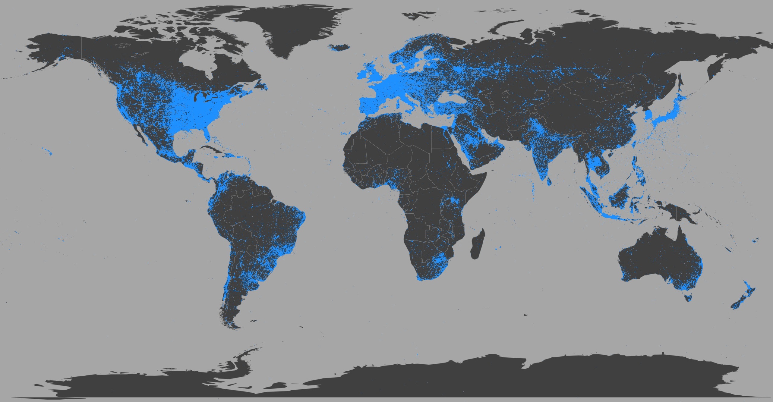
Visual Earth is the first study to analyze the growth of image sharing around the world in relation to economic, geographic, and demographic differences. We use a unique dataset of 270 million geotagged images shared on Twitter around the world between 09/2011—06/2014. We also look in detail at image sharing in 100 urban areas situated on six continents.
Visual Earth is the first study to analyze the growth of image sharing around the world in relation to economic, geographic, and demographic differences.
Project team: Dr. Lev Manovich, Daniil Sergeev, Agustín Indaco, Dr. Damon Crockett, and Dr. Mehrdad Yazdani.
We use a unique dataset of 270 million geotagged images shared on Twitter around the world between 09/2011—06/2014. In addition to analyzing all these posts worldwide, we look in detail at image sharing in 100 urban areas situated on six continents. Rather than only considering the world’s largest cities or capitals, we selected these cities using different criteria to better represent the diversity of urban life today. We started with a list of 500 urban areas with at least 1 million people. We then chose 100 cities from this list. The cities in our list vary in size, history, culture, and global importance; they are situated on all five continents in countries with different levels of economic development.
Project is supported by Twitter Data Grant, The Graduate Center, City University of New York (CUNY), and The Qualcomm Institute, Calit2 (the California Institute for Telecommunications and Information Technology).